The Larapinta Trail was amazing. To do it justice (and apparently this goes against all blogging ‘rules’), this is a very long blog post. But please, I would love for you to read it all, enjoy my thoughts and feelings I had along the way and also enjoy the pictures. I didn’t want to break it down into pieces as it didn’t really feel right to do that. Thanks!
I’ve been back a couple of days from my hike on the Larapinta trail. I keep stumbling on what to write in this post, I think because there simply are no words to describe how beautiful, perfect, spiritual and magical this part of the world is. I really haven’t known how to express my journey. It left me seriously lost for words, which is a first, even for me.
I feel so utterly privileged to be able to have undertaken, even a part of this trek. I saw some utterly amazing and breathtaking sites. I met some incredible people. I made some incredible friends. Hopefully, some of which I will have for life.
I slept under the stars in a swag, open in a riverbed, looking up at the stars and at all the planes flying over at 30,000 ft. I conquered a mountain at night with a head torch, I bathed in freezing cold canyon water, I used a shovel as a toilet.
I now appreciate that I need less stuff. I thought I packed minimally, but I could have only taken half of what I had and I would have been fine. I also appreciate the beauty in silence, in vast empty spaces, yet the smallest of details also made me smile. I appreciate running water. I appreciate it even more if it’s hot.
I loved every second of being offline. I was a little sad to turn my phone off flight mode when we got back into Alice Springs last Friday.
I had not one second of anxiety. Or sadness, or loneliness or depression. Actually I never do on a hike. Alone or in a group.
I don’t feel as though I’m quite finished with Larapinta. Or maybe Larapinta isn’t quite finished with me, yet. Next time, I want to do the whole trail, all 223km of it. Start to finish, front to back, top to bottom, beginning to end, soup to nuts. Unsupported (which means I carry all my own gear, tent, bed, cooking gear, food etc on my own), although when I say unsupported, I will utilise a crew to support in a safety capacity. I am getting quite down with these hiking terms now. #hikelife
I did my tour with Women Want Adventure. Monique the CEO is an absolute legend. We were safe, warm, well catered for and above all else everyone had a blast. I recommend checking out her website and if interested, it costs nothing to express your interest. They do heaps more than just hiking – canyoning, rock climbing, kayaking….heaps of things.
22 women absolute legends were on this tour, there were a couple of people that came away together, but mostly we were all there s solo travellers. All with different reasons for being on the tour, backstories and goals for the 5 days.
Location and Itinerary
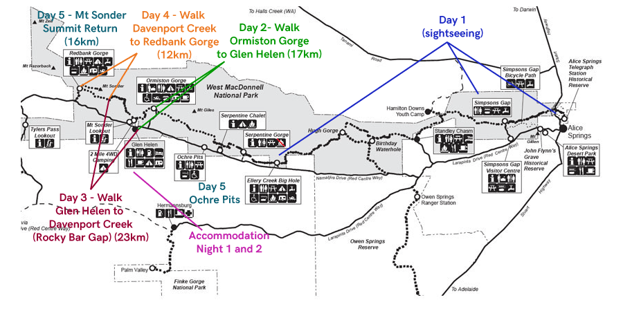
Overall the Larapinta trail is 223km broken down into 12 sections. I was on a 5 day tour, which tackled sections 10, 11 and 12. In all Ormiston Gorge to the summit of Mount Sonder.
If you add up the official kilometres for each section, it adds up to 63km, however we easily hiked closer to around 80km. On all of the days, my iPhone registered over 20km, and closer to 25km on the 3rd and 5th days!
Let’s go!
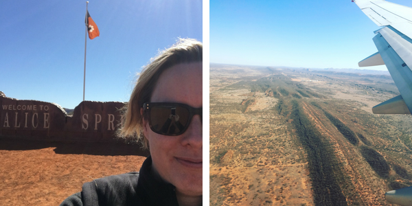
Welcome to Alice Springs! The start of the West MacDonnell Ranges!
Day 1 – Alice Springs to Glen Helen Gorge (Travelling Day)
The trip doesn’t officially start until about midday, but those of us who stayed the night before got up at the crack of sparrows to hike about 8km out to the Telegraph Station in Alice Springs (which is also the official start of the Larapinta Trail).
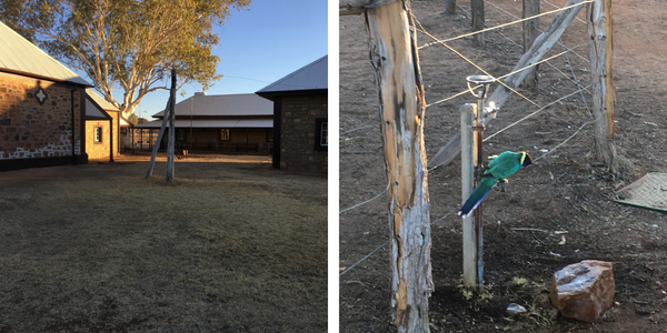
Alice Springs Telegraph Station (start of the Larapinta Trail only 3km out of town) and one of the many parrots with really cool colours in Alice Springs
Then onto picking up the rest of the group from the airport and onto the “Trail” in a sightseeing capacity, on our way out to Glen Helen Gorge, to set up Camp for the night.
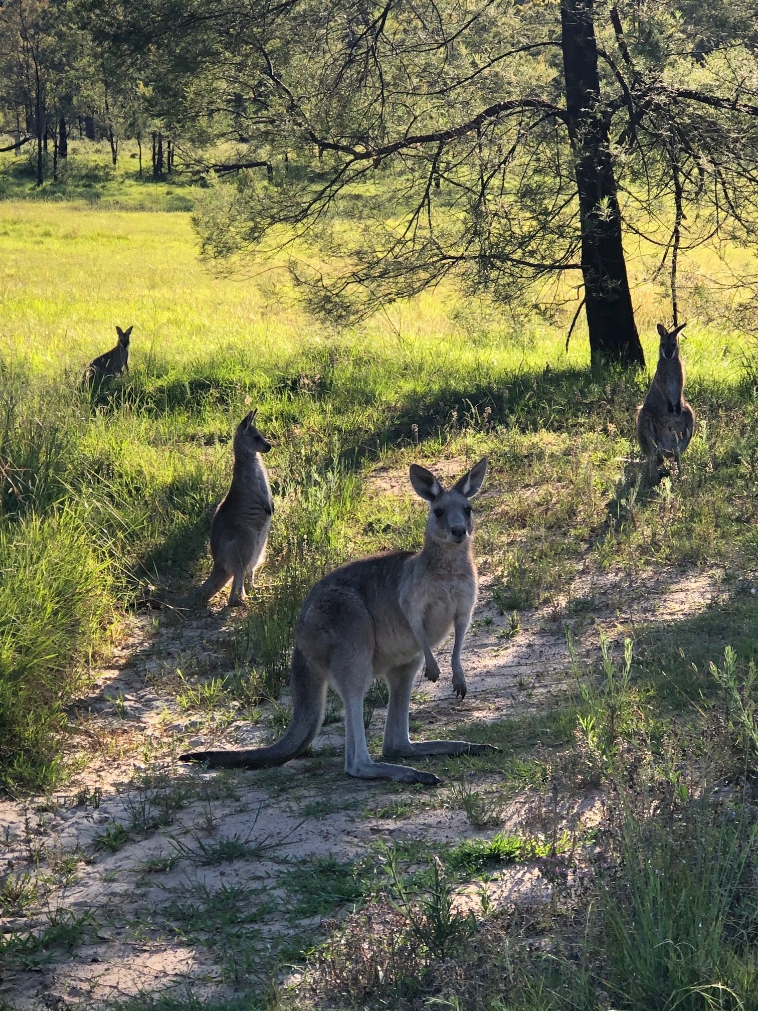
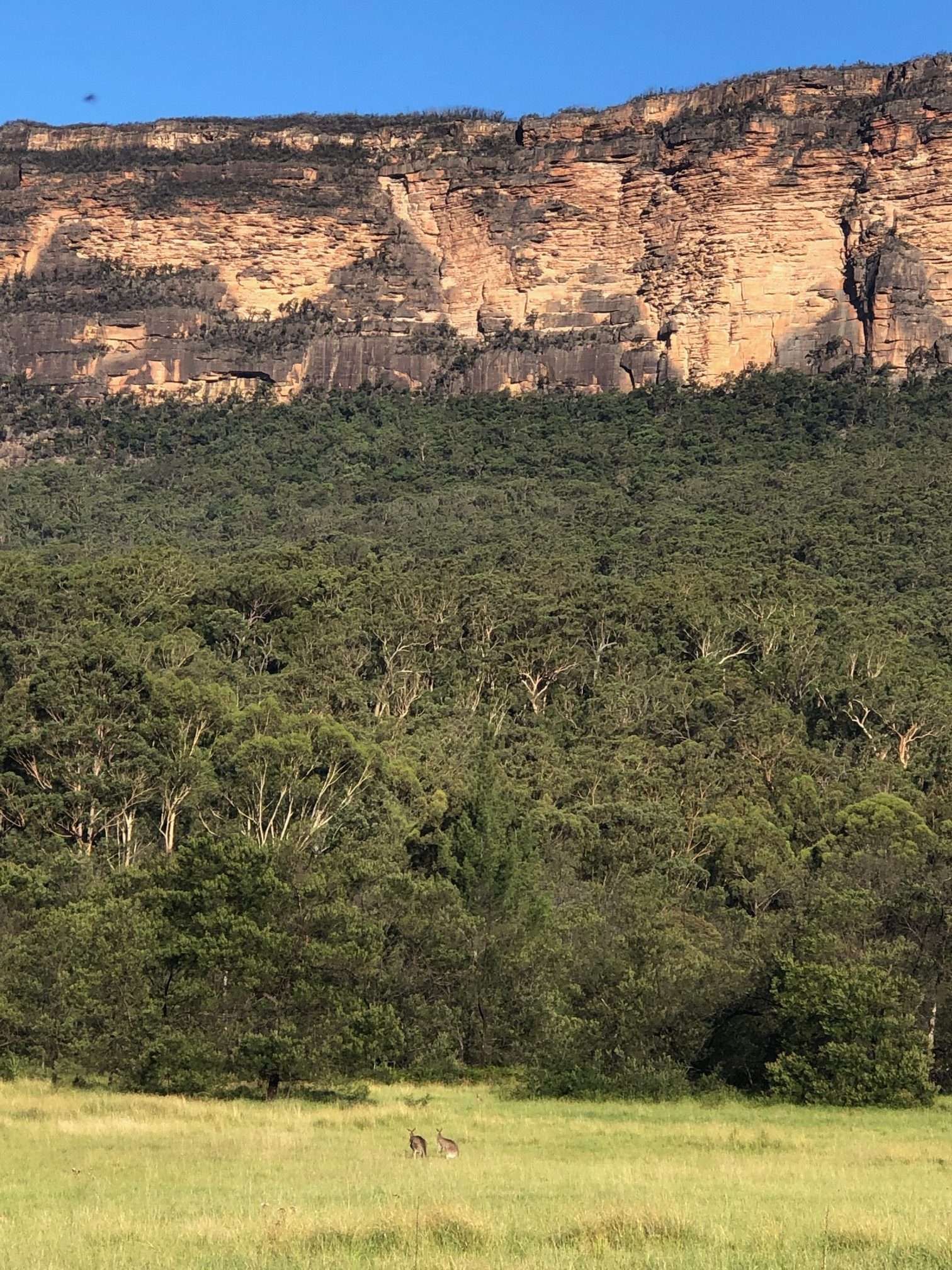
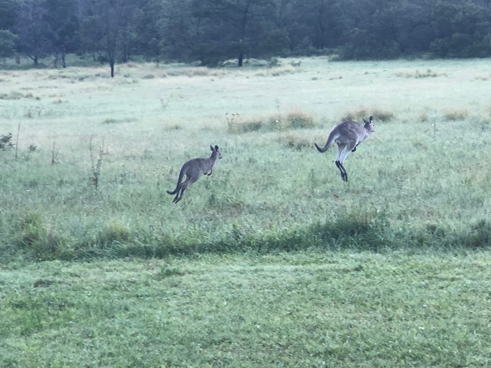
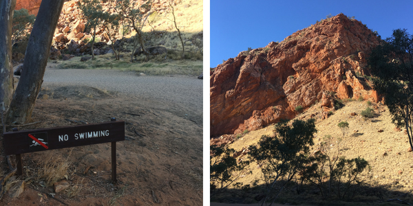
We stopped at Simpson’s Gap and Ellery Creek (Big Hole), saw some rock wallabies (which don’t photograph very well on an iPhone)
Simpsons Gap
River Red Gum and Simpsons Gap
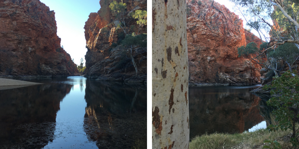
Ellery Creek Big Hole – that’s it’s name it’s really not a bad place!
Day 2 – Ormiston Gorge to Glen Helen Gorge
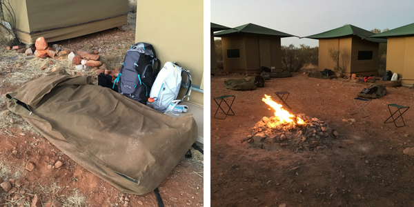
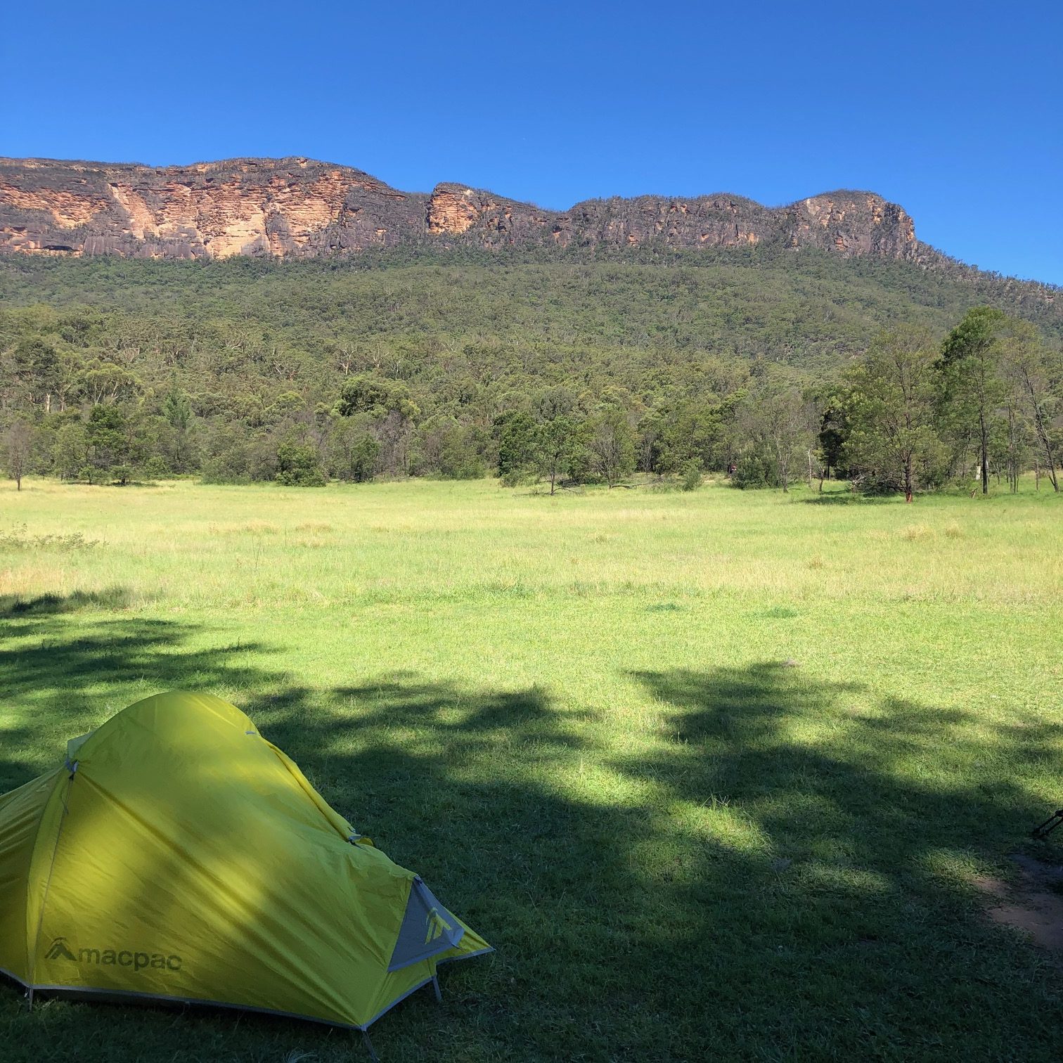
My first swag and campfire for the night
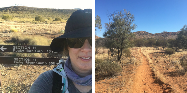
The Trail in this section is 12km from Ormiston Gorge to the Finke River Camp. A couple of hills, but relatively easy walking. We added another 3-4km on to get to Glen Helen Gorge Camp where we had also stayed the night before.
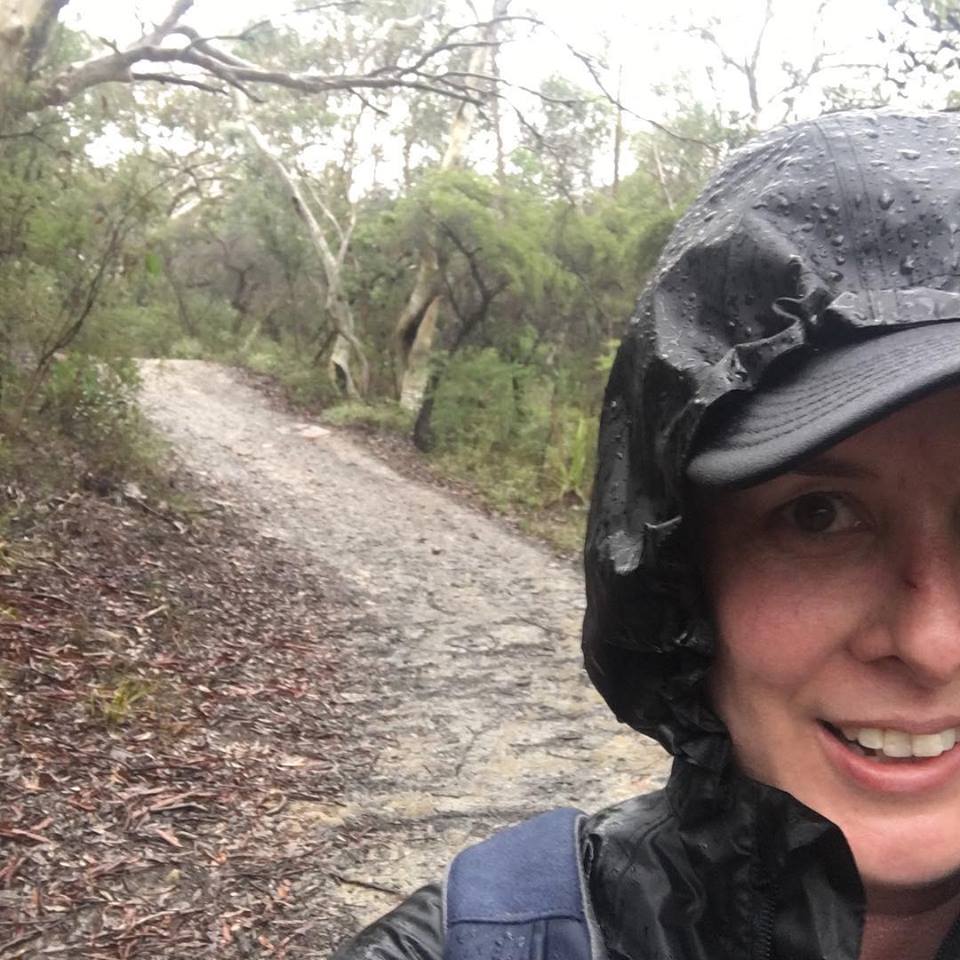
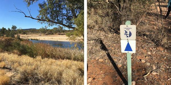
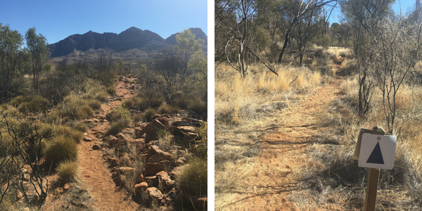
One of the first things that strikes you on the Larapinta, apart from the scenery, is how well the trail is marked, even when walking completely alone, sometimes for hours. I never ever felt as though I was lost, you barely pass one trail marker, before you see the next one.
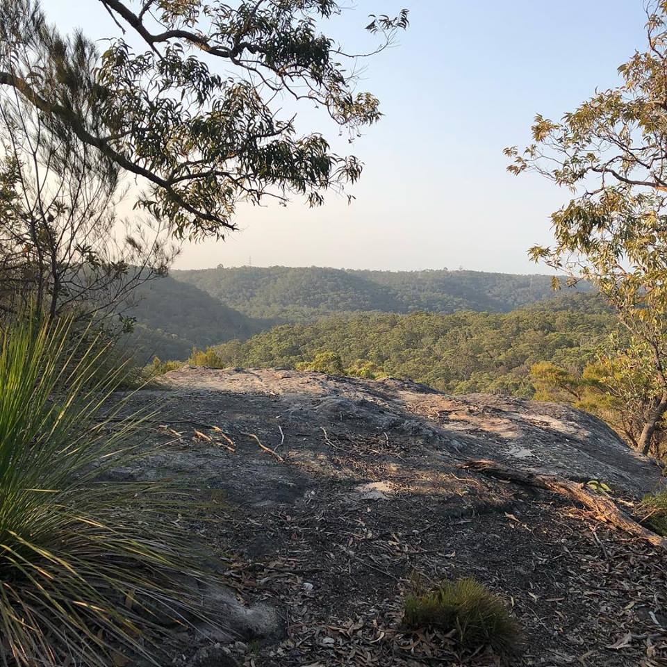
Ormiston Gorge and the first glimpse of Mount Sonder!
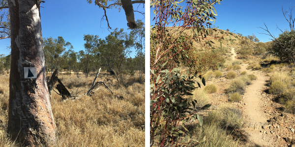
Larapinta trail arrow and a good, well defined track make for a happy hiker
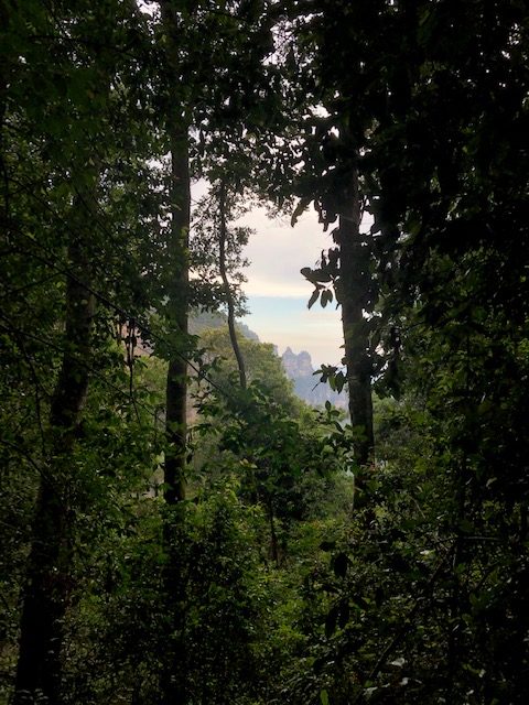
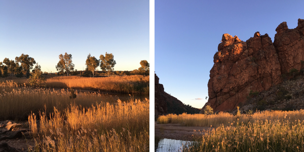
Ormiston Gorge is just as beautiful as the other gorges along the trail, slightly more ‘famous’ than many of the others. We hiked up to the lookout over the top of Ormiston, before starting on the trail. This section had lots of open ‘plains’ type scenery and good walking, solid dirt ground, not many sand or rocks. Some early glimpses of Mt Sonder at the end of our hike, that at this stage seems so far away!
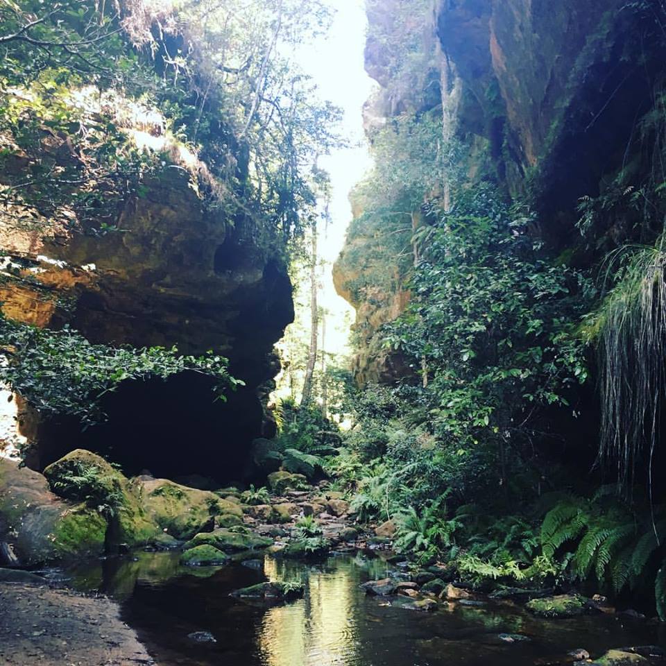
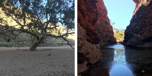
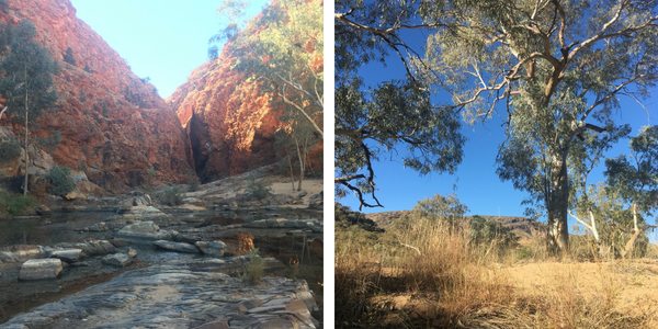
The walk back to Glen Helen Gorge for camp passes through a ‘hole in the wall’, some interesting rock formations and the Finke River.
Finke River and obligatory trail marker shot
After a shower, I went down to the gorge to take some photos at sunset.
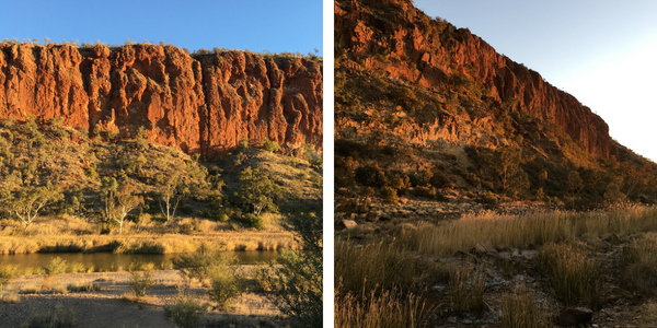
Glen Helen Gorge at Sunset
Glen Helen Gorge at Sunset. There is a public bar at Glen Helen Gorge and an caravan/camping area for the public. And also luke-warm running water!
Day 3 – Glen Helen Gorge to Davenport Creek
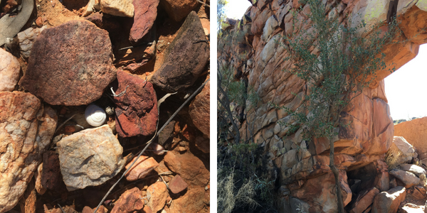
Another little moment – looking down to find in between the rocks, a tiny shell in the middle of the desert. The second is the hole in the walk that the trail going from Larapinta to Glen Helen Gorge goes through.
This was a long walking day, the official section is around 18km but getting out of Glen Helen and back to the Larapinta Trail and again between about 1-2km between Rocky Bar Gap (official Larapinta Campsite) and Davenport Creek (private property).
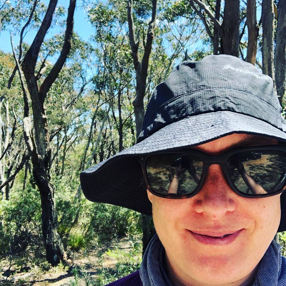
On this day, I really noticed the change in scenery on the Larapinta trail. One minute you are walking on rocks, the next minute sand, then the scenery looks like the moon.
Larapinta: Bad skin never looked so good
It was this day that I: Saw some dingo tracks, camped in a creek bed, used a bush toilet (i.e. a shovel!), used a drop toilet, heard about a snake siting (I wasn’t going over to double check), had a great time setting marshmallow kebabs on fire in the campfire.
My all time favourite moment of the day was when I was walking alone, and I got further ahead of my group than I thought, and I stopped for about 2 minutes and there was just complete and utter silence. Nothing. And I had that thought, the thought that I am in the middle of Australia, hiking, alone (semi-alone) and it’s just me and the outback. I thought of how significant it felt, yet also how insignificant I am in the overall timeline of life on earth. That my life really is a blip. That these formations are 600 million years old and if I’m lucky I’ll probably be here for about 80 of them. That all that daily life stuff, work, paying bills, shopping for clothes, etc is really not at all important. It sounds so cliche, writing it now but I am really glad I had that moment. Even though you kind of think it already before you do these things or have these moments, it was just a point in time where everything ‘clicked’.
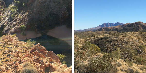
Looking towards Mt Sonder (the really pointy bit is where we walk to – the true summit is only permitted for climbers unfortunately can’t walk there), and a sandy part of the trail
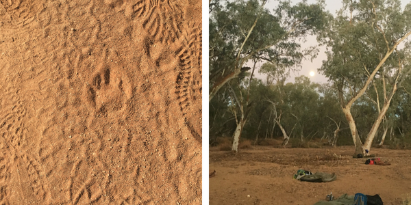
Tracking a Dingo! and Camping in a dry riverbed for the night under the moonlight.
Day 4 – Davenport Creek to Redbank Gorge
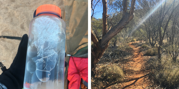
By far the coldest morning I have every had to sleep in and more importantly change my duds in – outside. I woke up to find that the night had gotten so cold, that not only was there ice build up on the inside of my swag, but the zippers were also covered in ice so I was frozen in. My 1L water bottle was frozen solid, and even the drool on my pillow had frozen and the pillow was a stiff as a board.
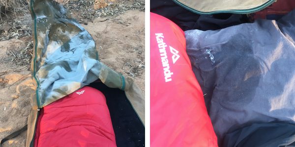
Yep – that’s ice inside my swag and frozen drool on my pillowcase – keeping it classy
This was a day of relatively ‘easy walking’. It didn’t feel easy, it felt like my feet were made of lead. But none the less I was glad for a relatively flat walk, well marked trail and an early finish to rest up for the final morning.
It was the changes in scenery that made it enjoyable. I also enjoyed the opportunity to just take everything in at my own pace, walking alone, and thinking about where I was and how lucky I was to have this amazing opportunity.
1L water bottle frozen solid, and red dirt track – good walking!
One of the highlights I had was actually at the end of the day, at the top of the hill near camp, looking toward Mount Sonder. I got a rare chance to have a ‘deep and meaningful’ chat with one of the other ladies on the tour. One that I had chatted to briefly a couple of times, but this time got to share our backstories, and really got to connect. In this amazing place, under the light of a full moon.
Another ‘moment’ was had when I was lying in my swag looking up at the stars and the overhead air traffic (of which there is a lot if you can see it in an outback sky), it made me realise again, how small and insignificant I am, and how small all my problems in life seem. I felt like a tiny spec in a giant universe, which I totally am. Just a spec – in size and time.
Redbank Gorge and view from my swag during my afternoon lazy time!
Day 5 – Mount Sonder
Each night we had a safety briefing on the next day, so I knew we would be getting up at 2:30am to walk up Mount Sonder in head torches to be there for sunrise. Knowing this we all slept in our hiking gear
Mount Sonder is pretty much relentlessly all uphill, at varying degrees. For 8km. Then the bit that is worse actually – downhill. Relentlessly all downhill again for another 8km. So now that I think about it everyone has to do Larapinta Section 12 twice. The reason I found downhill worse was pretty much just the tiredness. The track on this section is mountainous, rocky, shale, to muddy type goat track at the bottom. You need to check your foot placement on every step. It would be easy to slide, roll an ankle or just trip over. Especially if you got up at 2am. In most places there are clear margins and space between you (the path) and a sheer death drop. The approach is from behind Mt Sonder and is a fairly wide saddle. Towards the summit there is a little scramble as well as there is no clear path.
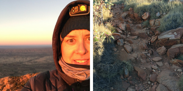
A very happy but also very cold hiker, and the lower half of the trail looks like this – when your brain and your muscles are at their most tired.
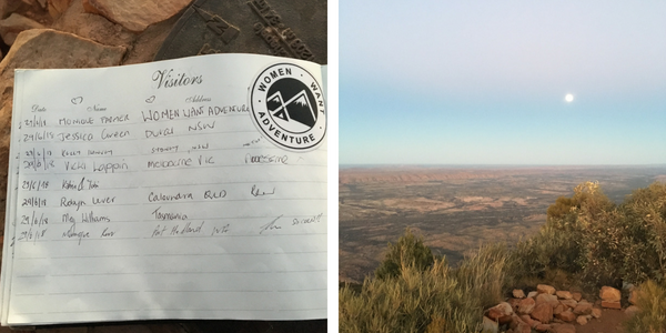
The visitors book shows that Women Want Adventure and find it at the tops of mountains, my scrawl with frozen hands is second from the top! Plus bonus view including moon from the top!
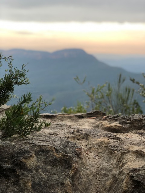
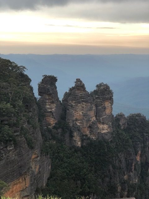
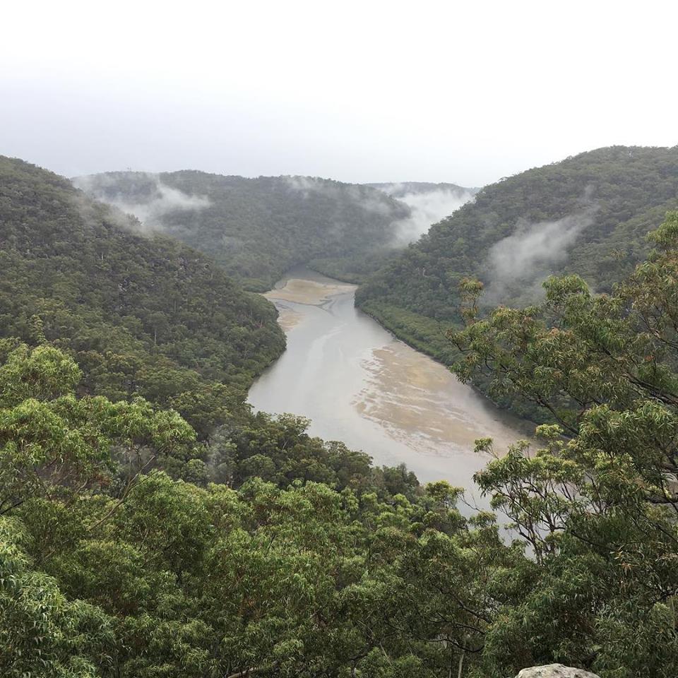
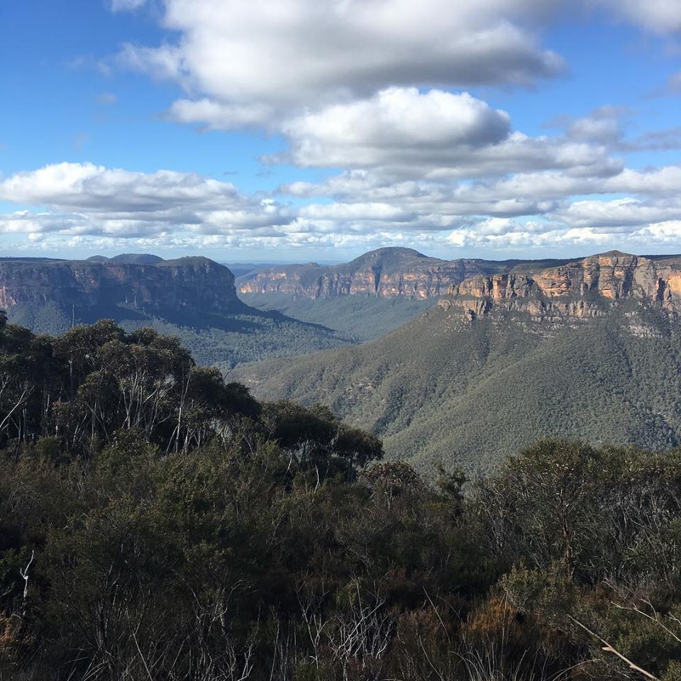
When you do get to the top, the view is amazing, we could make out pretty much where we started (Ormiston), Glen Helen Gorge, Rocky Bar Gap.
You can see why the aboriginals refer to the West MacDonnell ranges as rows of caterpillars.
It was bitterly cold at the top. As the sun came up, it was very much a unique and shared experience. Difficult to photograph, so you really just had to take it all in.
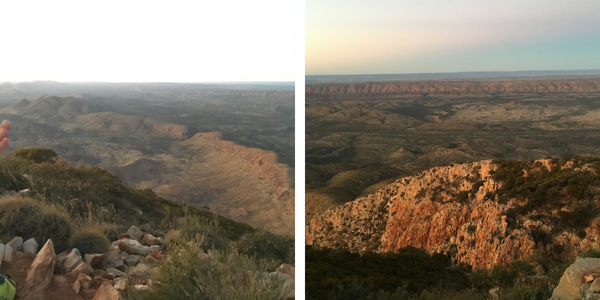
Looking back towards where we started. The gap in the rock is Rocky Bar Gap. Second pic is another shot looking out at the West MacDonnell Ranges.
It wasn’t until later that day, after a long hot shower back in Alice Springs, that I think it all dawned on us, what we had just experienced – together. I think while you are hiking up (and back down) a mountain, it’s easy to downplay what you need to do to get to the top, as it can be the only way to get through it.
I was actually quite thankful (after we did it) that we went up the hill with head torches, in the dark, rather than in the early hours of daylight. I think if I had been able to see how much was left to hike, how steep it was and how difficult the terrain was in places, it would have made it far far more difficult, and easier to give up on.
Back in Town
Overall the experience was amazing. It sounds so cliche but for me it was not just the physical challenge but the emotional and spiritual ones, that made me feel like i’d conquered or achieved something unique.
However, I still feel as though I the Larapinta Trail hasn’t finished with me yet. It wants me to do it all. All 1-12 sections, all 223km, all hills, trees, rocks, sand.
Even though that means another 2am up to Mt Sonder!
Thanks for reading all of this, I know it is a massive blog post and probably too many pictures, but I felt that if I broke it down into 2 different blog posts, that I wouldn’t be doing the experience justice. Thank you so so much for reading it all. It means so much to me. xxx
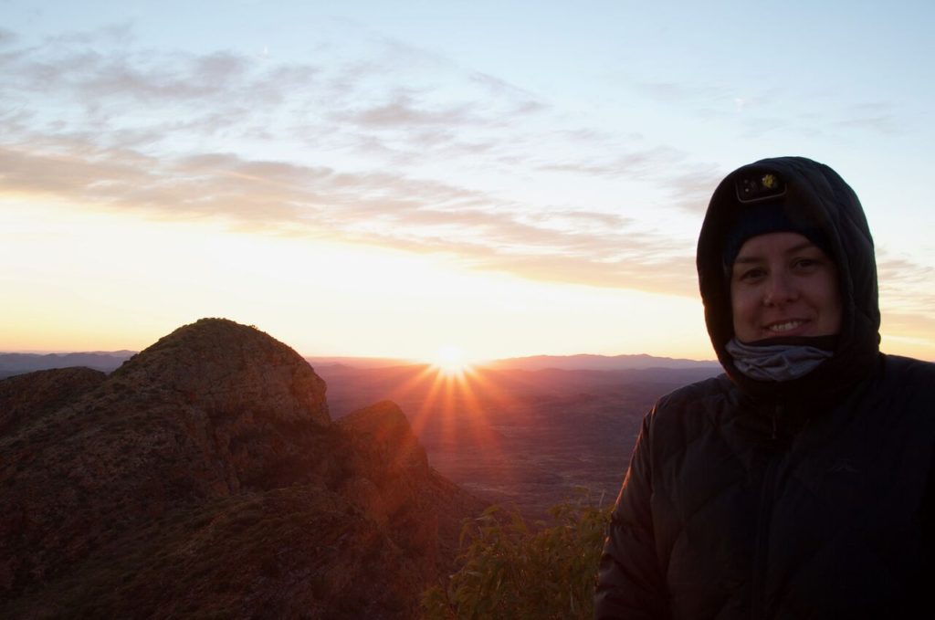
Me at the moment of sunrise. Photo by Monique Farmer of Women Want Adventure.